Crimean Mountains are the perfect hiding place for military warehouses and perfect location for radar stations. They are scattered around Bakhchysarai raion and territories of Alushta and Yalta city councils, to the south of Simferopol highlighted in our previous material.
We address our series of materials about Russian military objects in Crimea, legitimate targets for Ukraine, to our citizens in the Autonomous Republic of Crimea and Sevastopol. They need this information, in order to stay away from these objects and secure their personal safety.
Bakhchysarai warehouses
Bakhchysarai raion is the storeroom of an engineering equipment of the Russian Black Sea. Plateau Subvlu-Kaia rises above the Old City of Bakhchysarai.

Warehouse of an engineering equipment of the 758th center of material and technical supply of the Black Sea of the Russian Federation, Bakhchysarau. Photo: Yandex
The plateau hosts an engineering warehouse (coordinates 44.754853, 33.867905) of the military unit 63876 \ the 758th center of material and technical supply of the Black Sea of the Russian Federation (Lisova street, 3) and warehouse of the 133rd brigade of material and technical supply of the Russian Black Sea (Lisova street, 1). Two warehouses with different addresses look like one unified storage complex.

An engineering warehouse of the 758th center of material and technical supply and warehouse of the 133rd brigade of material and technical supply of the Russian Black Sea. Bakhchysarai. Photo: GoogleEarth
The 133rd brigade of material and technical supply of the Black Sea of the Russian Federation has its permanent location in Bakhchysarai, at Simferopolska street, 42 (coordinates 44.760908, 33.863834).
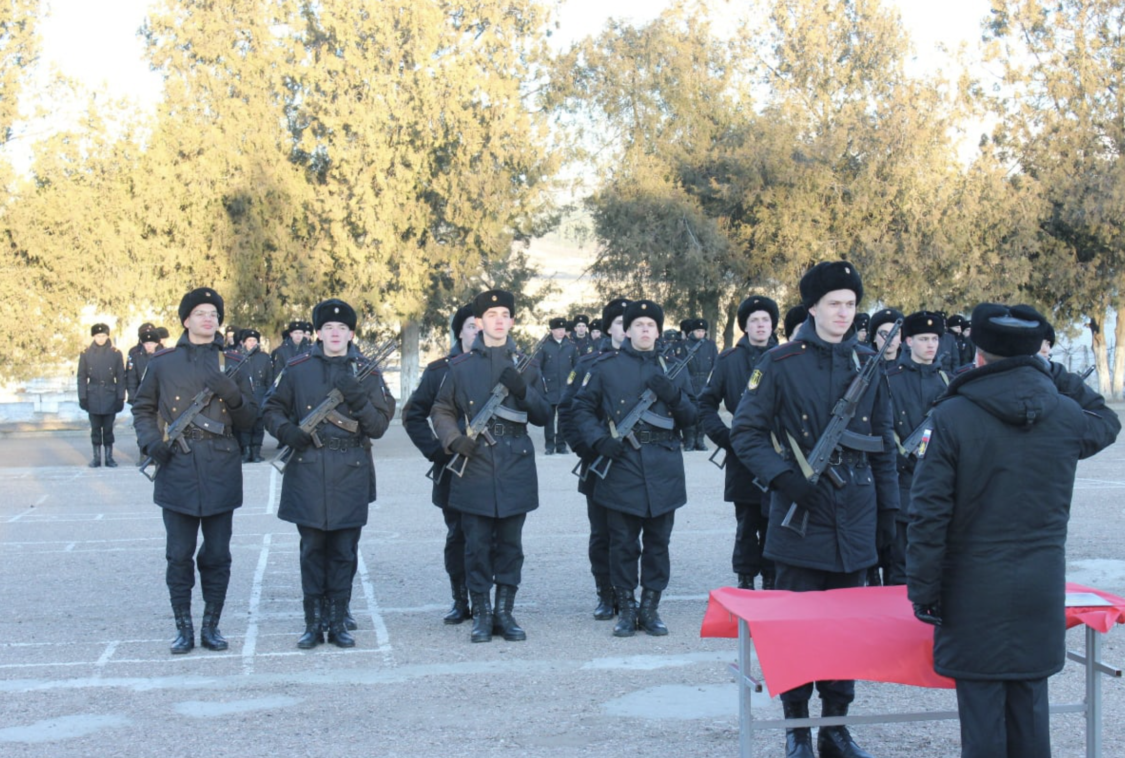
Taking an oath in the 133rd brigade of material and technical supply of the Russian Black Sea. Photo: VK Виктория Пластовец
Barracks, headquarters, military equipment and vehicles are located in this place. It should be noted that the 133rd brigade secures supplies and logistics for the 22nd army corps of the Black Sea of the Russian Federation. This army corps participates in the Russian aggression against Ukraine.
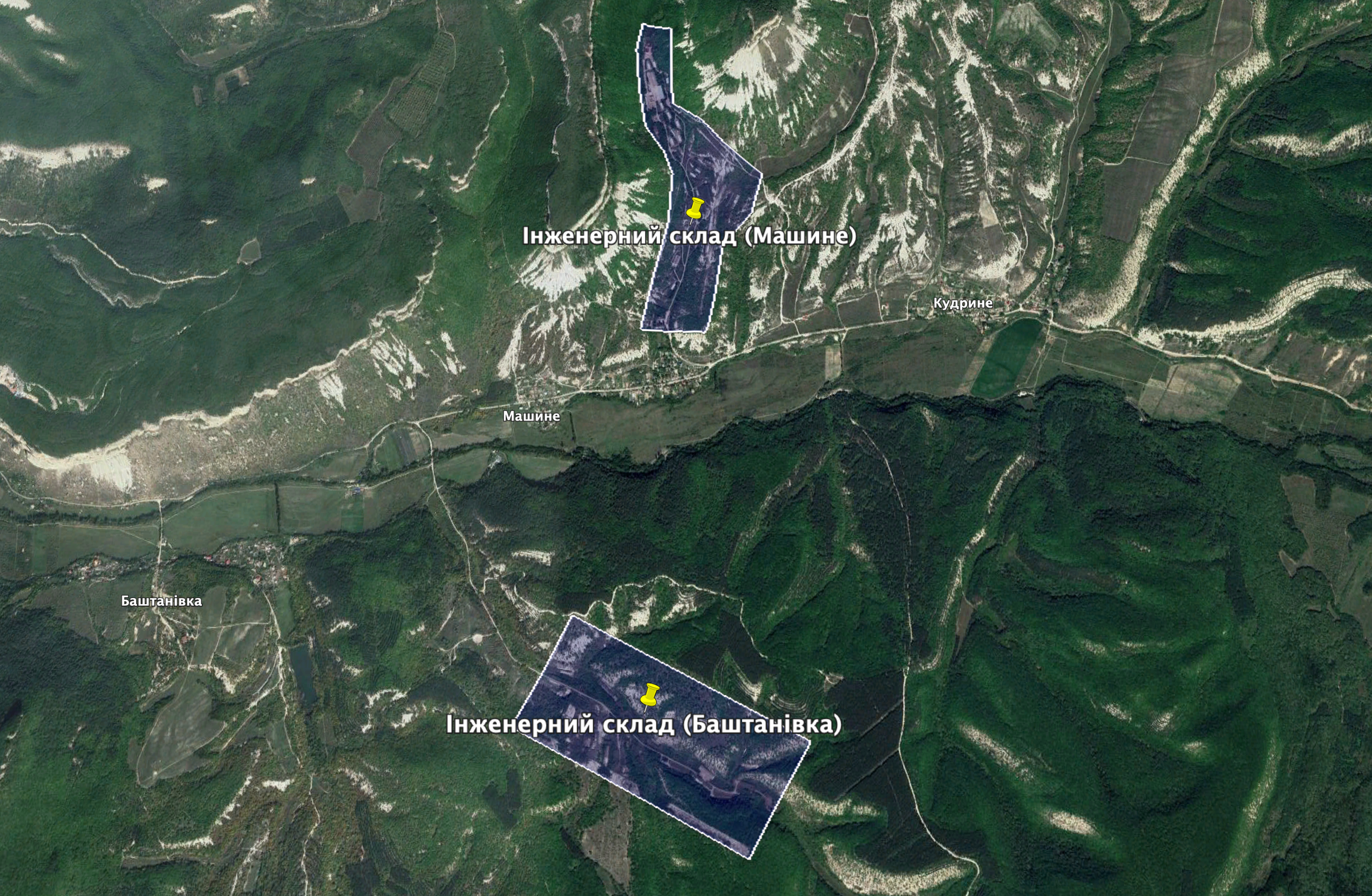
Engineering warehouse of the 758th center of material and technical supply in Mashyne and Bashtanivka villages, Bakhchysarai raion. Photo: GoogleEarth
Two large engineering warehouses of the 758th center of material and technical supply of the Russian Black Sea are located in the foothills of Bakhchysarai raion. These places were well known before the advent of Google maps and satellite pictures as they were popular among tourists who took numerous pictures of warehouses and military equipment “hiding” in the foothills.
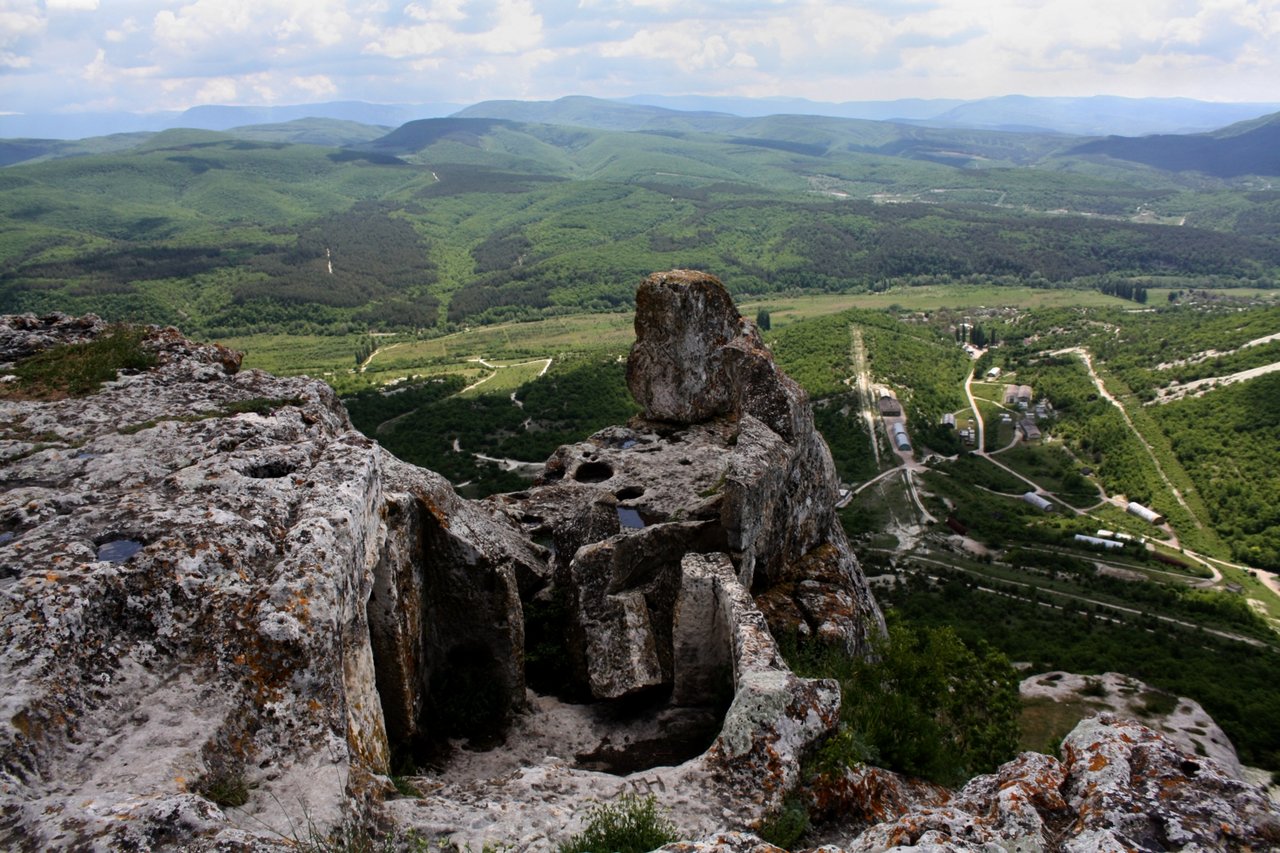
Buildings of an engineering warehouse of the 758th center of material and technical supply of the Russian Black Sea in Mashyne village. View from Tepe Kerman Mountain. Photo: Тамара И.Т.В./Yandex
For example, the warehouse (coordinates 44.708618, 33.926804) near Mashyne village (Tatarköy) on the right side of Kachyn Canyon is well observed from popular tourist “Tepe Kerman cave city” and from Kyz Kerman cliffs from the other side of canyon.

An engineering warehouse of the 758th center of material and technical supply of the Russian Black Sea near Bashtanivka village. View from Kyz Kerman Mountain
The second warehouse of the 758th center of material and technical supply of the Russian Black Sea (coordinates 44.684285, 33.923855) is located between Mashyne and Bashtanivka (Pıçqı) villages, on the left side of Kachyn Canyon. Satellite pictures clearly show the quadrant in canyon as well as buildings of warehouses and parking spaces for vehicles.

“Radio field” of military unit # 80162 of the Black Sea of the Russian Federation. Photo: GoogleEarth
There is also a radio technical object in Bakhchysarai raion. Five tall radio masts can be seen along routes Bakhchysarai-Pischane or Simferopol-Mykolaivka. It is so-called “radio field” (coordinates 44.888857, 33.873428) of military unit # 80162 of the Black Sea of the Russian Federation near Gorka \ Plodove villages.
Radars of the Southern Sea Shore
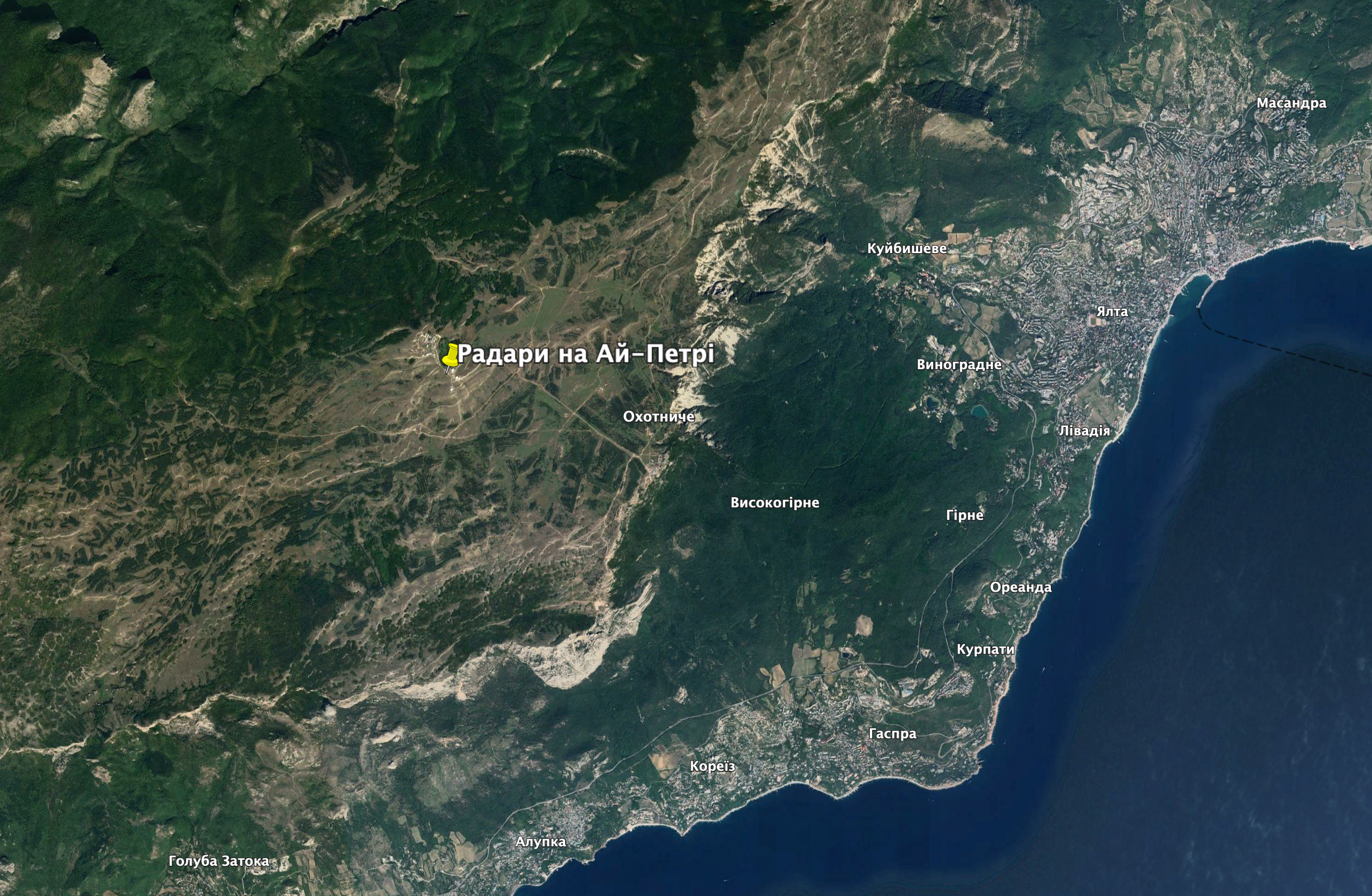
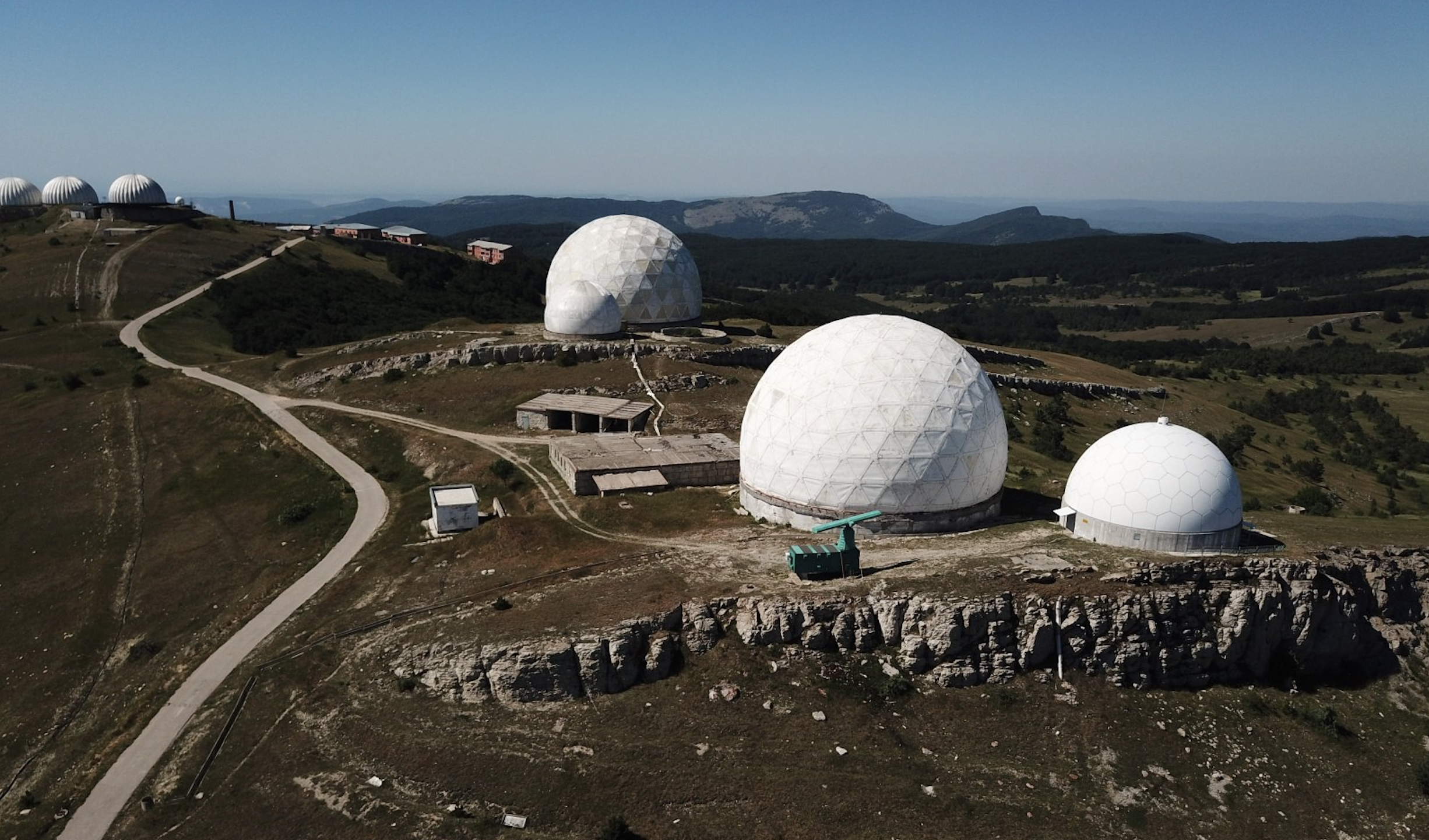
White domes near Ai-Petri Mountain are the most famous military object of Great Yalta. Radars covered by radio transparent domes at Bedene Kyr Pique (coordinates 44.481491, 34.033617) стали однією з візитівок гірського Криму.
Before the Russian occupation, the Ukrainian radio radar battalion was located there, with Soviet complexes “Oborona”, “Altai”, “Granitsa-M” and Ukrainian 36DS-6.
Russians put the 3rd radio regiment of the Russian Air Forces there. It is unknown whether they placed the modern equipment there. However, Soviet complexes were able to survey and control the sky above Crimea and surrounding Black Sea.
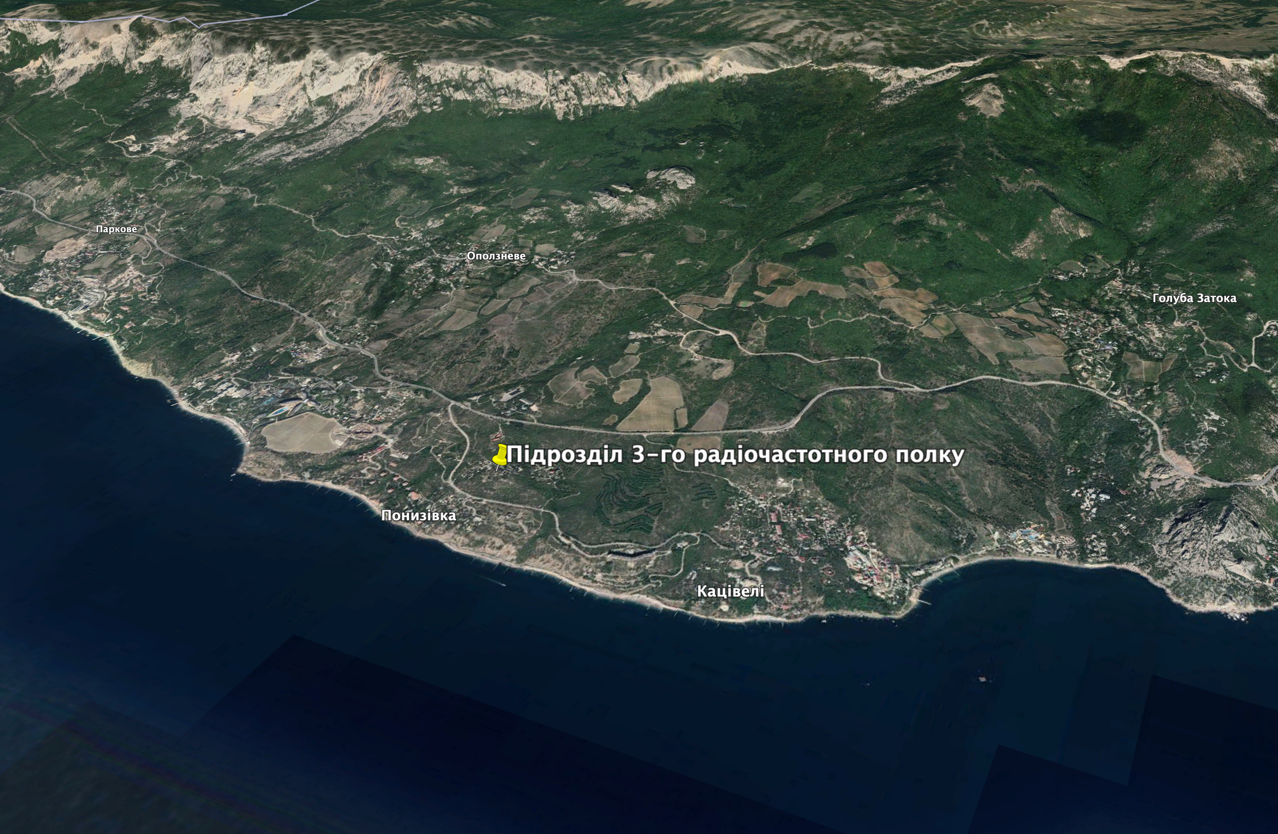
Object of the 3rd radio regiment of the Air Forces of the Russian Federation, Ponyzivka village. Photo: GoogleEarth
Another unit of the 3rd radio regiment of the Air Forces of the Russian Federation (coordinates 44.395437, 33.955649) is located in Ponyzivka village (AşağıKikineiz).
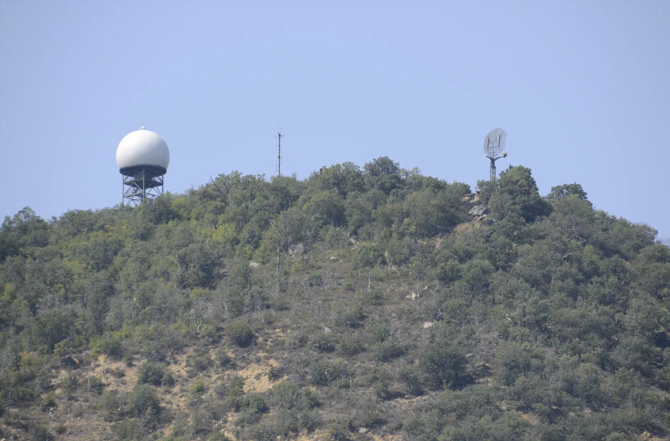
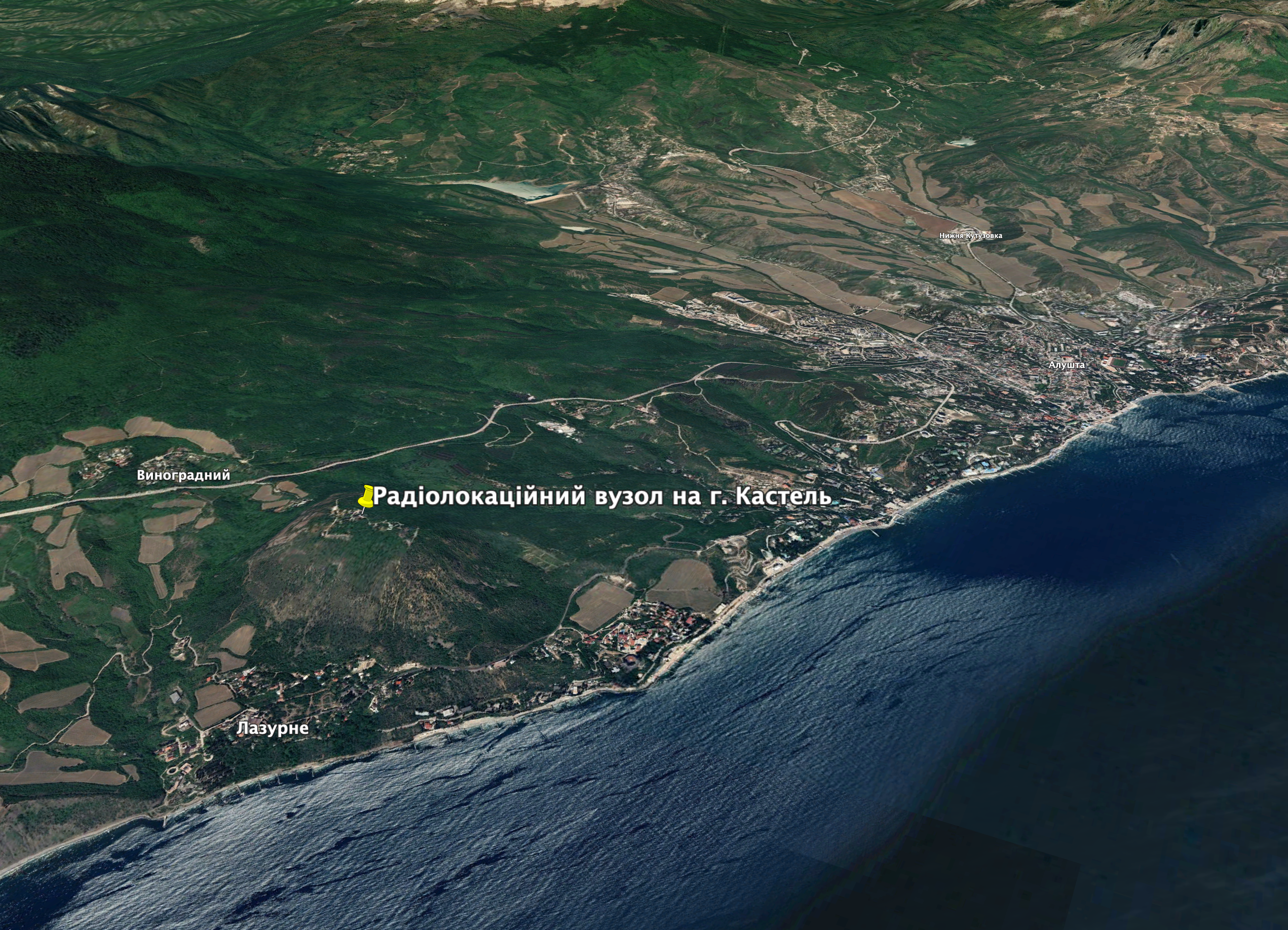
Next radio unit of the same regiment (coordinates 44.639964, 34.385480) is located on Kastel Mountain. Russian occupants built radio transparent dome between 2018 and 2019 there.
Peaceful inhabitants of Bakhchysarai and Ponyzivka should look for other residential places, far from dangerous military neighbors. Families of Russian troops at Ai-Petri Mountain should leave Crimea, together with their soldiers.
OSINT-investigator Irakli Komakhidze published “Full list of fire hazard objects of Crimea”, with all Russian military objects in Crimea. They are all legitimate targets for the Armed Forces of Ukraine. We will try to describe them and show their locations.


