The territory of Sevastopol is full of Russian military objects. Sevastopol City and neighboring villages can be called the giant naval base. Several hundred thousand civilians live among military units, warehouses, bases, anti-aircraft regiments and berths for military ships. This overview is published to inform them about safety hazards.
Unlike previous materials, the overview of Russian military targets in Sevastopol is divided into three parts. Current article focuses on the Northern Side – the right bank of Sevastopol Harbor and all military objects located to the north.
We address our series of materials about Russian military objects in Crimea, legitimate targets for Ukraine, to our citizens in the Autonomous Republic of Crimea and Sevastopol. They need this information, in order to stay away from these objects and secure their personal safety.
As an administrative unit, Sevastopol is not only “white city” in Sevastopol Harbor as it has been perceived by tourists for years. It is the giant territory – from Lukull Cape in the north to Cape Sarych in the south (the southernmost point of the Crimean Peninsula; the length is 51 kilometers) , from Chersonesus Cape at the westernmost point of Heracles Peninsula to Uzundzhi River in Crimean Mountains in the east, close to the Baydar Valley (the length of this axis is 44 kilometers). Sevastopol includes cities Balaklava and Inkerman as well as 39 rural settlements. The area of housing (50 square km) almost equals the area of military objects (49 square km). We will talk about military objects.
Kacha Airfield (Qaçı, coordinates 44.779151, 33.567837) is the northernmost military object on the territory of Sevastopol City Council. It is used by the 318th separate mixed air regiment of the Black Sea Fleet of the Russian Federation.
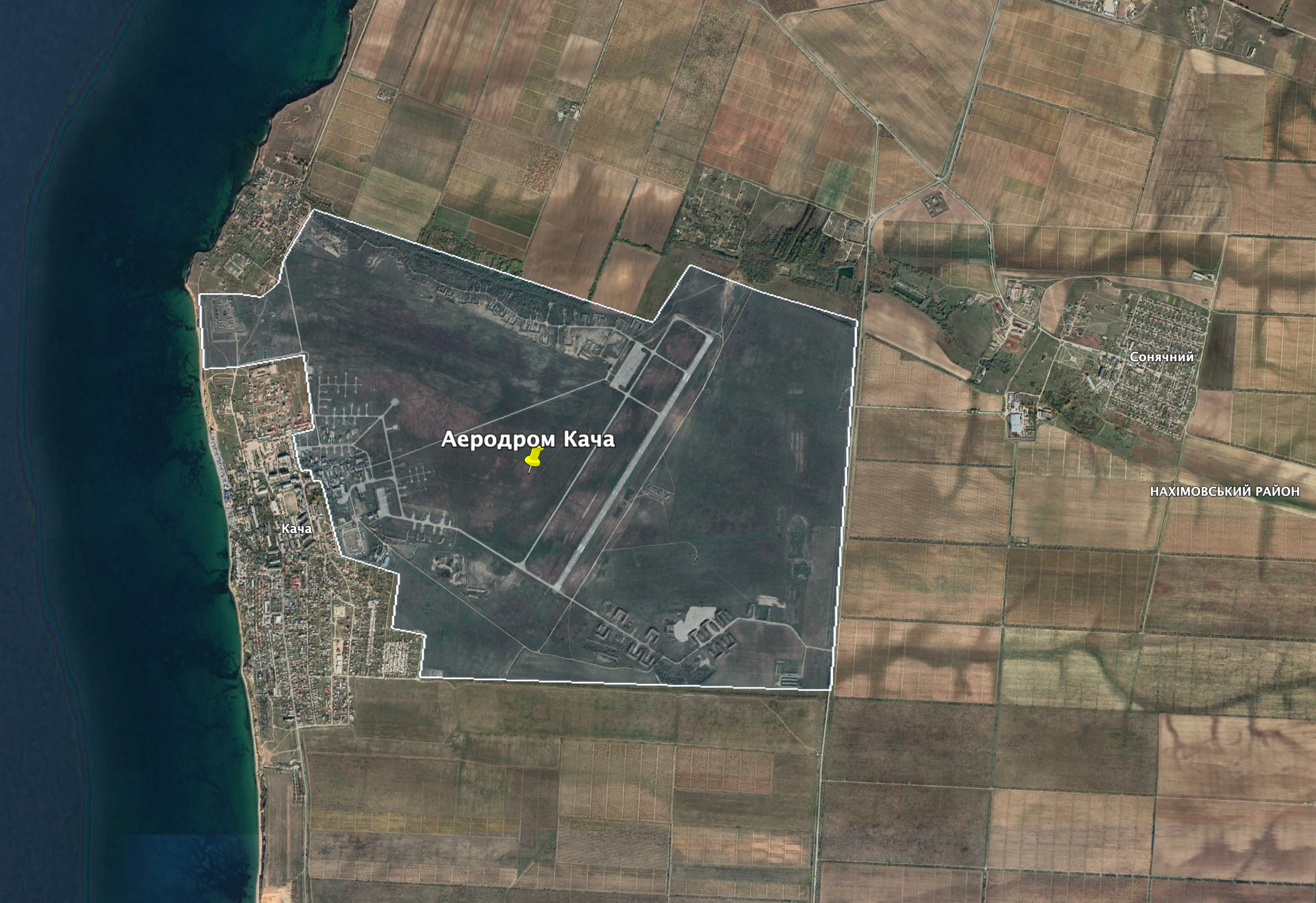
Kacha Airfield. Photo: Google Earth
The Russian Air Forces flew from the Kacha Airfield to strike Ukrainian territory. That is why it is advisable to destroy the runway of the airfield and to damage air equipment there.
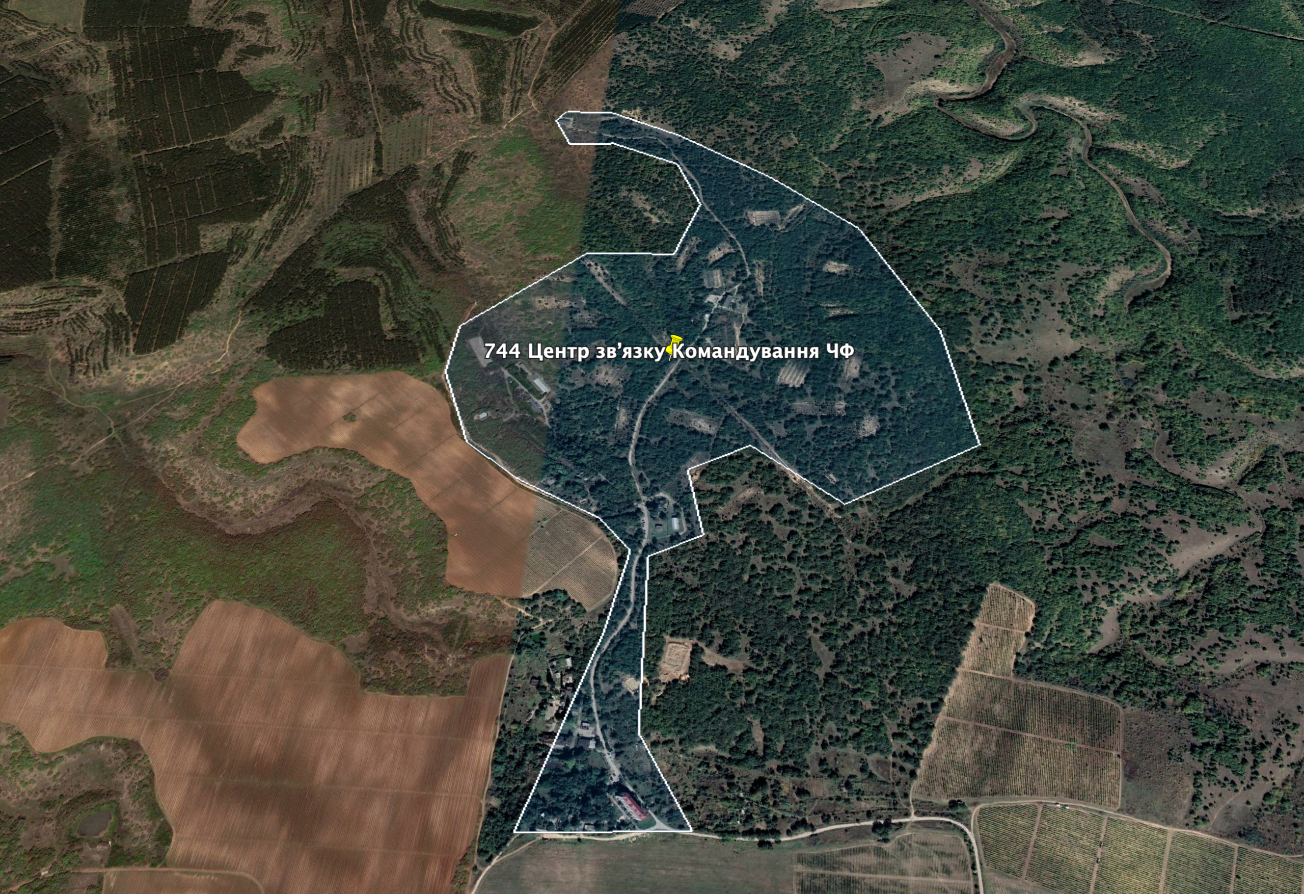
Objects of the 744th communication Center of the Headquarters of the Black Sea Fleet of the Russian Federation , Verkhnosadove. Photo: Google Earth
Objects of the 744th communication Center of the Headquarters of the Black Sea Fleet of the Russian Federation are hiding in the forest to the north from Verkhnosadove (Duvanköy) (coordinates 44.706738, 33.707250). Before the Russian occupation, Reserve command center of the Ukrainian Navy was situated there (military unit А2929). Commanding is, first of all, about powerful system of protected communication. If it will be destroyed, then, the army will be disorganized.
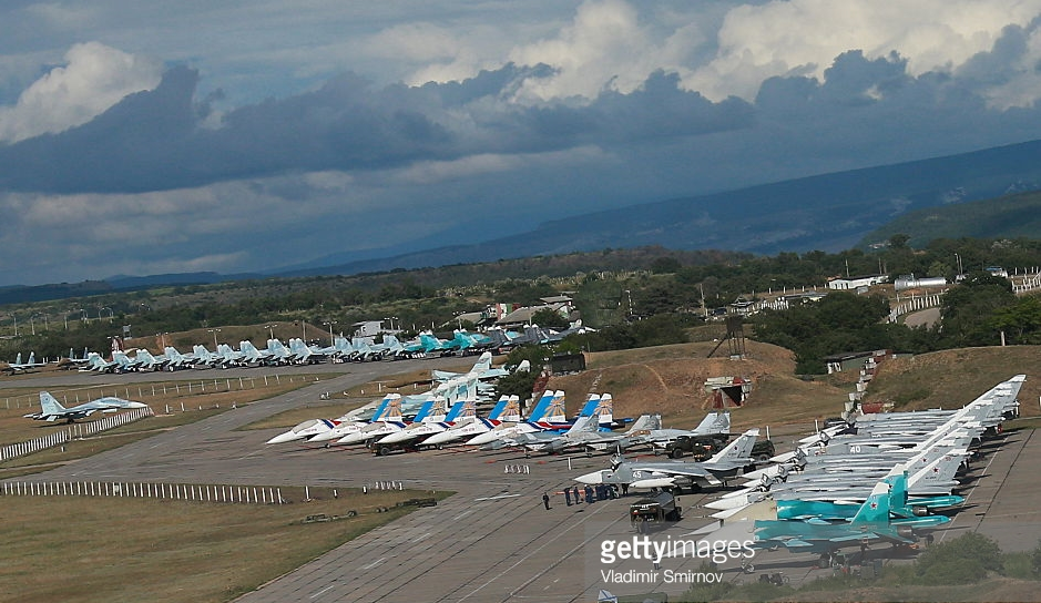
Fighter jets at Belbek Airfield. Photo: Vladimir Smirnov / GettyImages.com
There is another airfield – “Belbek” (coordinates 44.692102, 33.575418). The 38th regiment of fighter aircraft is stationed at this airfield. Its personnel lives in neighboring district “Lubymivka” (coordinates 44.671469, 33.552144). The airfield is protected by the division of the 12th anti-aircraft missile regiment (coordinates 44.678921, 33.554266).
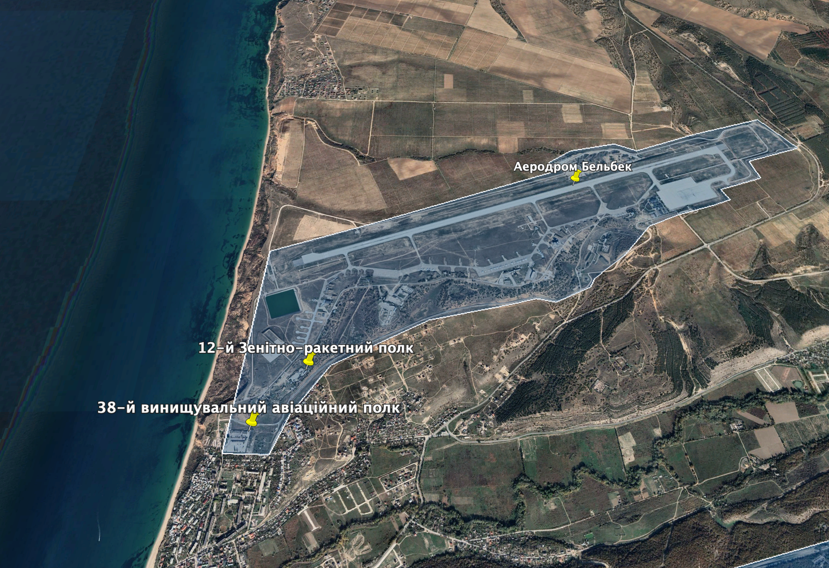
Belbek Airfield . Photo: Google Earth
Dramatic photos of Belbek in 2014 became the most known photos of the Russian occupation of Crimea.
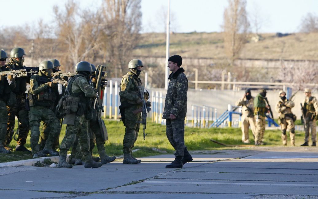
Belbek Airfield. March 2014. Photo: Reuters
Large base of mine and torpedo armament of the 758th center of material and technical supplies of the Russian Black Sea Fleet is situated on the other side of Belbek Valley (its coordinates 44.665057, 33.596951). It is as large as Lubymivka district. The region of MacKenzie Mountains originates here (it hosts a lot of military objects).
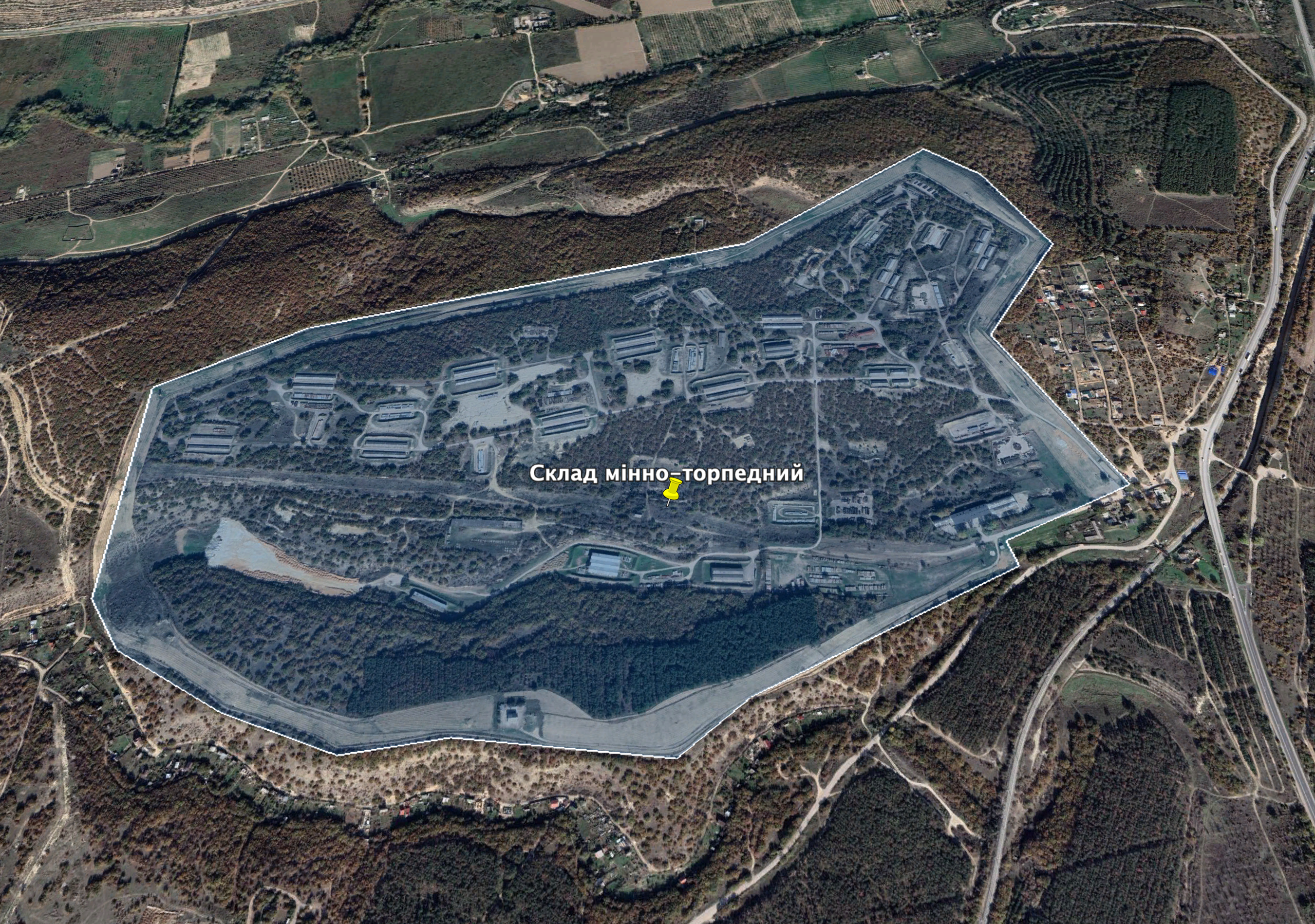
The base of mine and torpedo armament of the 758th center of the Black Sea Fleet of the Russian Federation. Photo: Google Earth
The base of missile armament of the 758th center is situated in the forest one and a half kilometers to the south east (coordinates 44.650313, 33.616861). Both bases have protected perimeters and large warehouses. It is unknown what exactly is stored in those warehouses. Their titles “mine \ torpedo” and “missile” are taken from official Russian documents.
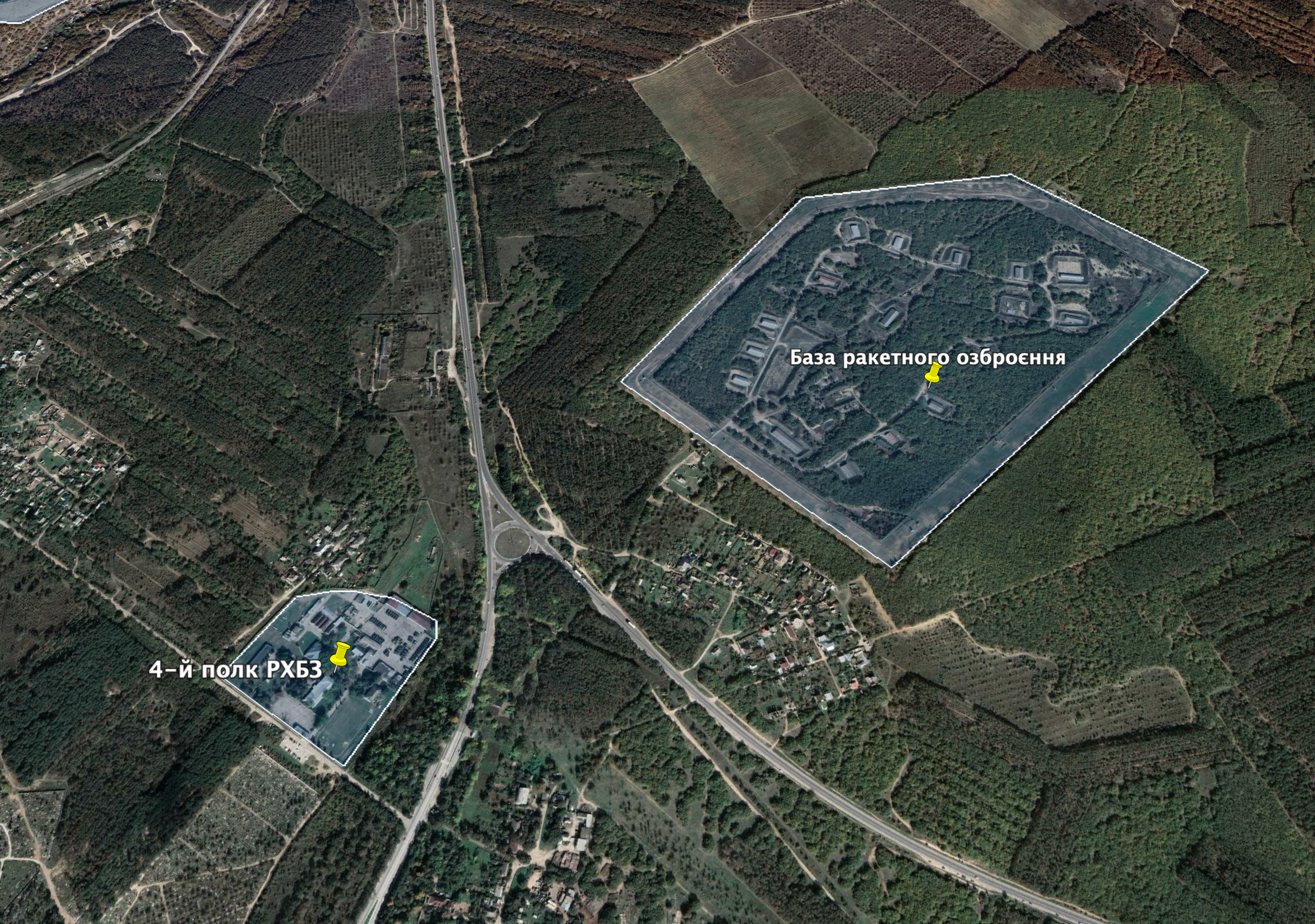
Base of missile armament of the 758th center of the Russian Black Sea Fleet and the 4th regiment of radiation, chemical and bacteriological protection. Photo: Google Earth
The 4th separate regiment of radiation, chemical and bacteriological protection is located on the other side of the old Simferopol-Sevastopol highway (coordinates 44.644880, 33.604260). There was only two media news about this regiment. The first one was about its creation in 2014. The second highlighted the consecration of the chapel on its territory in 2020. The regiment is located in front of large cemetery “MacKenzie Mountains”.
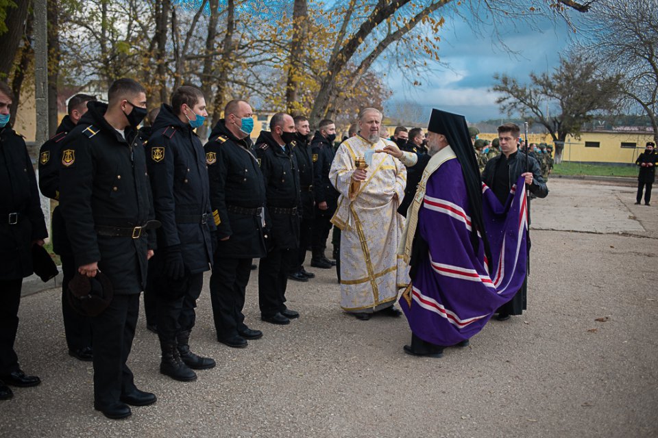
Nestor, the Yalta bishop, during the consecration of the Andrei Bogolubsky Chapel in the 4th regiment of radiation, chemical and bacteriological protection, Sevastopol. Photo: hersones.org
Another military object is situated on the other side of the cemetery (its coordinates 44.642691, 33.595825). The satellite photo demonstrates warehouses, hangars and military vehicles along the railway.
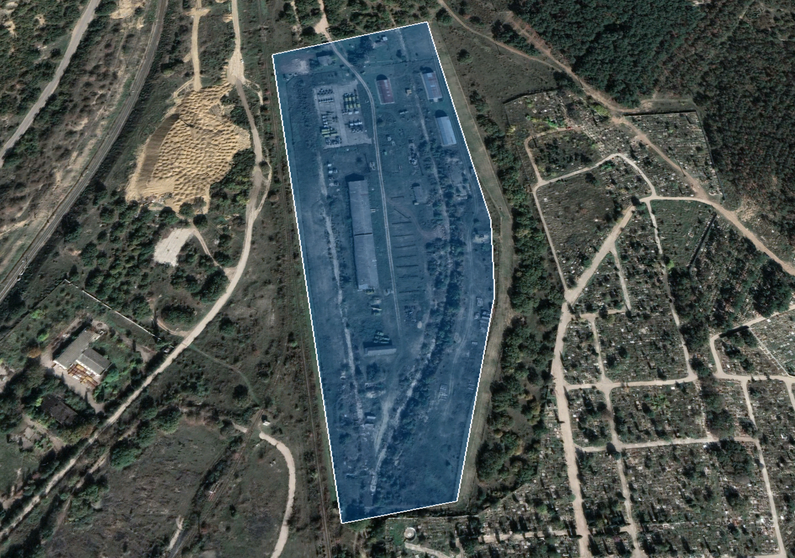
Warehouses and military vehicles of the Black Sea Fleet of the Russian Federation. Photo: Google Earth
Huge fuel warehouse of the Russian Black Sea Fleet is located to the south from the cemetery up to Grafska Bay.
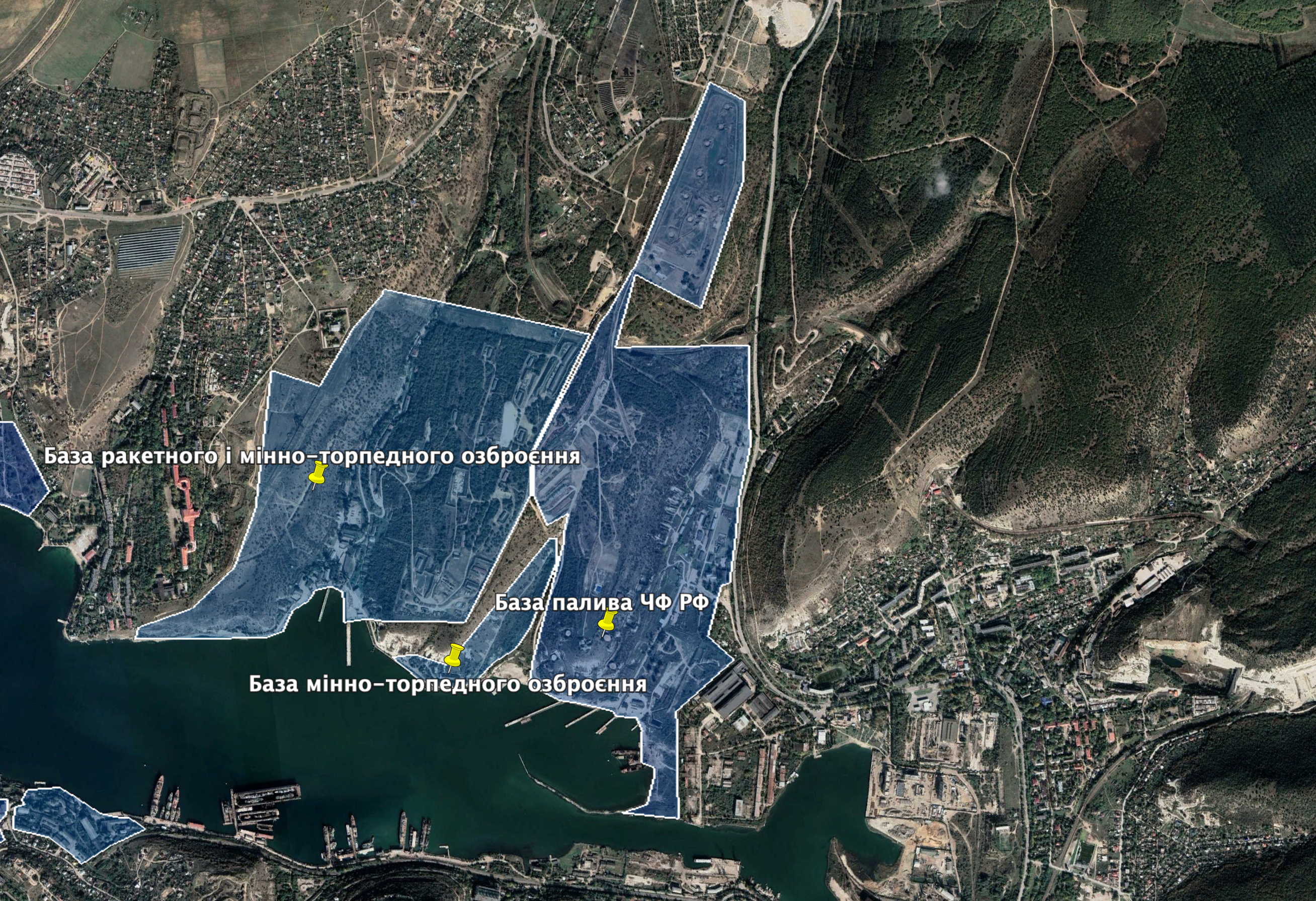
Fuel warehouse of the Russian Black Sea Fleet in Naftogavan (Oil Harbor), bases of missile and mine and torpedo armament in Sukharna Valley. Photo: Google Earth
It includes oil tanks, large cylindrical containers, oil terminal and underground warehouse restored by Russian occupants in 2019.

Entrance to the underground fuel warehouse. Fuel warehouse of the Russian Black Sea Fleet in in Naftogavan. Photo: neftegaz.ru
Bases of missile and mine and torpedo armament of the 758th center of the Black Sea Fleet are located in nearby Sukharna Valley (coordinates 44.626441, 33.583587). Their area is the same as the area of neighboring fuel warehouse. Buildings and dormitories of the Ukrainian National University of Nuclear Energy and Industry are located in Holland Bay (Russian occupants turned the University into the branch of the Sevastopol State University).
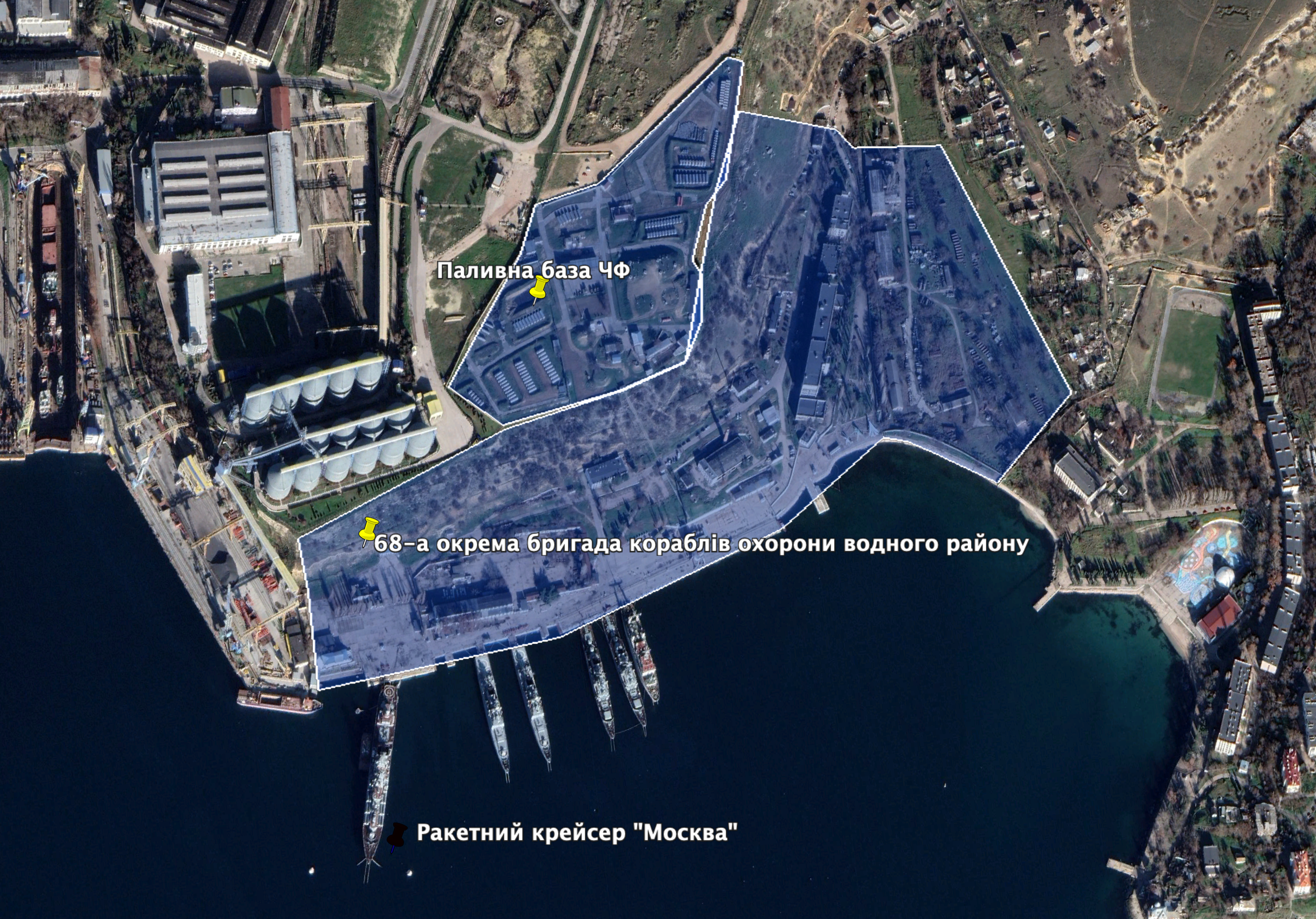
The 68th brigade of ships of the Black Sea Fleet of the Russian Federation, the fuel base and missile cruiser “Moscow”, 2020. Photo: Google Earth
The berthing wall of the 68th separate brigade of ships of the Russian Black Sea Fleet is located near buildings of the University (coordinates 44.624781, 33.558383). Russian missile cruiser “Moscow” also stood here before its destruction by the Armed Forces of Ukraine in spring 2022. The 2020 satellite picture shows it near grain terminal. Another fuel base of the Russian Black Sea Fleet is also located here (coordinates 44.627286, 33.558062).
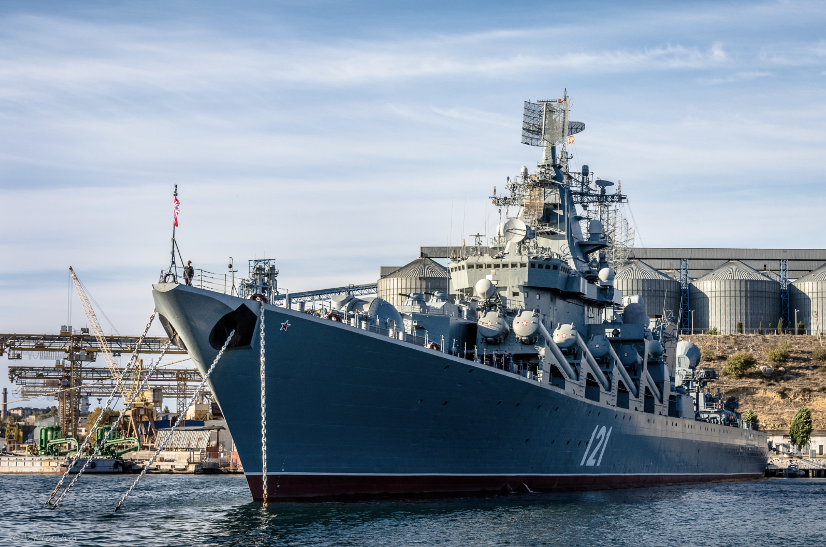
Missile cruiser “Moscow” in front of grain terminal “Avlita”. Photo: Vladimir Kleschev /Google Earth
Grain terminal “Avlita” was owned by Ukrainian oligarch Rinat Akhmetov until 2016. Then, it was sold to companies of the Russian military industrial complex. After the Russian full scale invasion, grain terminal became the largest terminal through which Russia exports stolen Ukrainian grain. The 388th sea reconnaissance point of the Russian Navy is located in Engineer Valley (coordinates 44.627606, 33.544181).
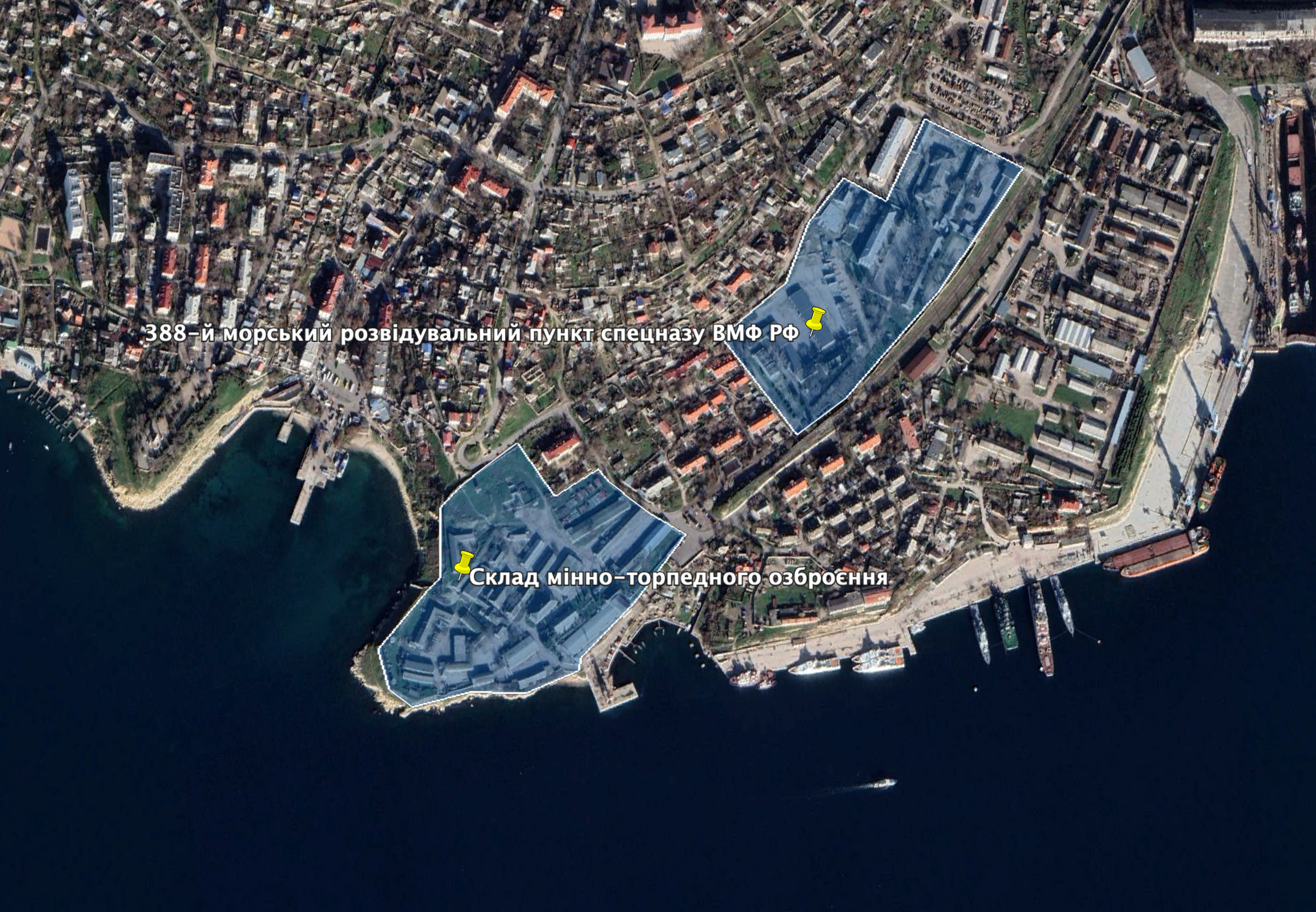
The 388th sea reconnaissance point and base of mine and torpedo armament at Kondrafos Cape. Photo: Google Earth
The reconnaissance point was transferred from Tuapse to Sevastopol after the Russian occupation of Crimea. This point had two special purpose companies and one company of underwater mining in 2015. Soldiers of the 388th reconnaissance point demonstrated landing from helicopter to ship during maritime parades in Sevastopol.
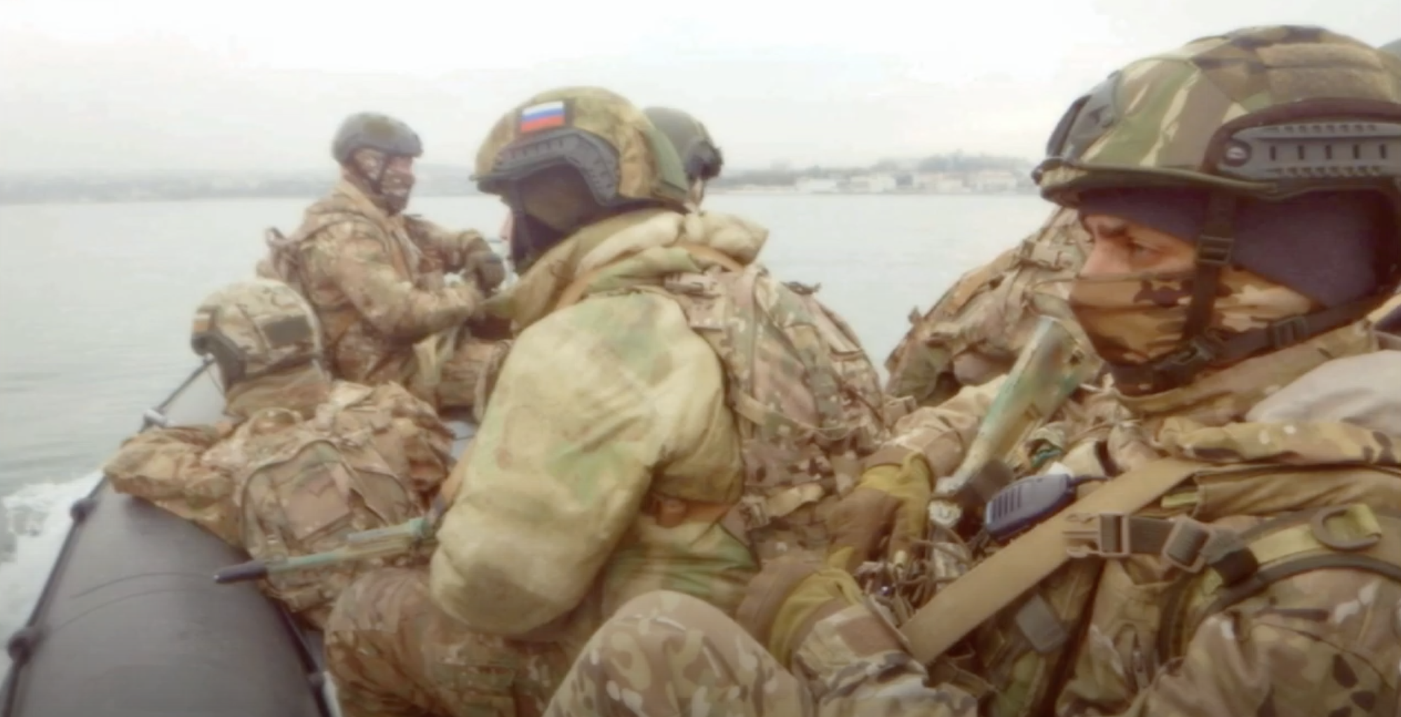
Soldiers of the 388th sea reconnaissance point during training. Screenshot: Youtube осн спн
After the full scale Russian invasion into Ukraine, the 388th point bears losses – bodies of its dead soldiers were brought from Snake Island to Sevastopol.
Warehouse of mine and torpedo armament at Kondrafos Cape. Photo: Den Rusakov/Google Earth
Another warehouse of mine and torpedo armament of the 758th center of the Russian Black Sea Fleet is located on the territory of the old 4th battery at Kondrafos Cape separating Engineer Harbor from Northern Bay (coordinates 44.624464, 33.538529).
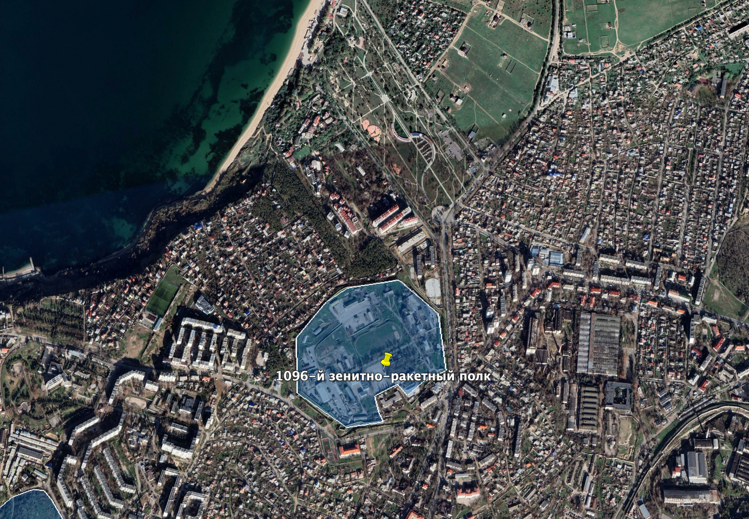
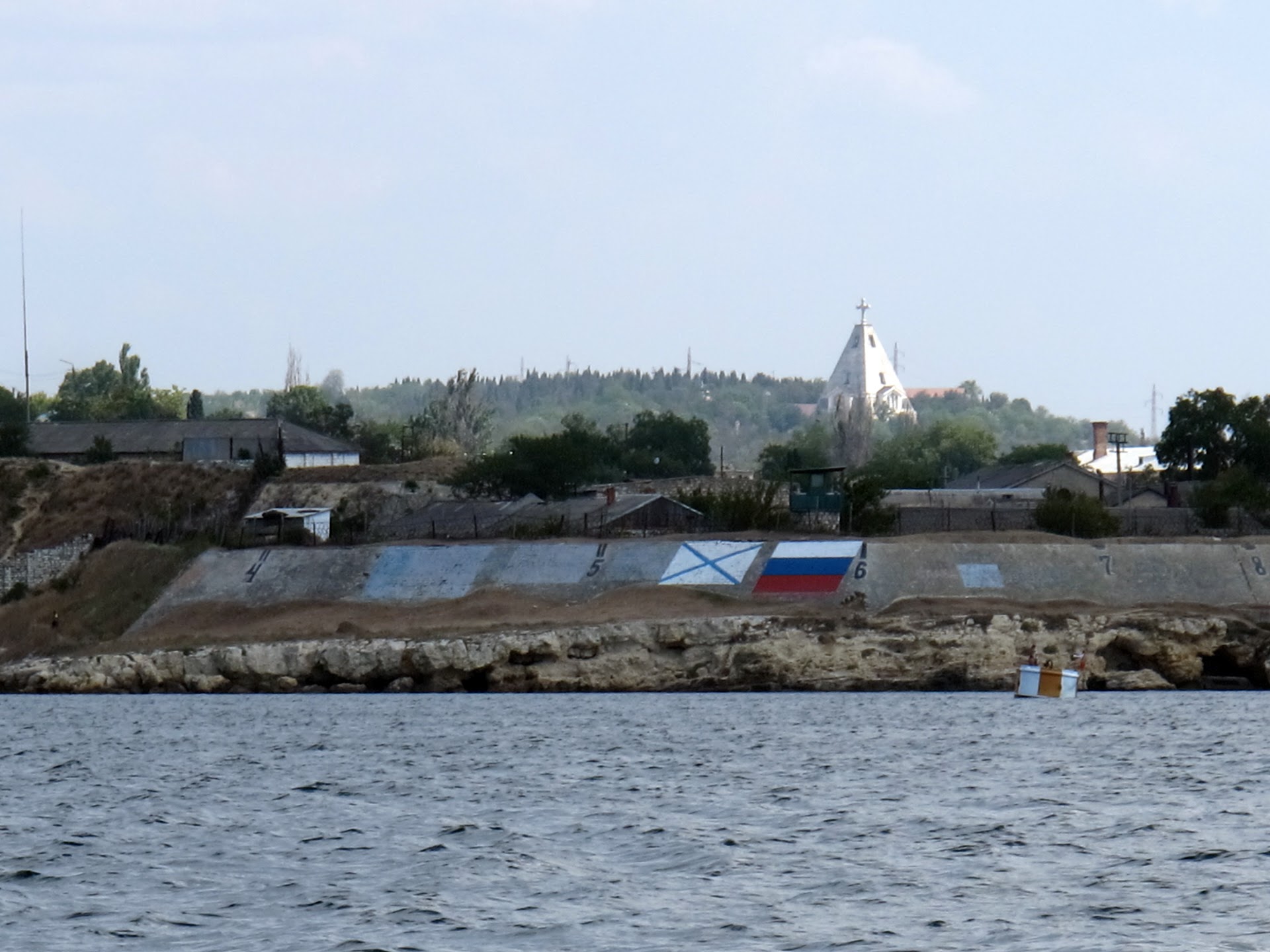
The 1096th anti-aircraft missile regiment. Photo: Google Earth
The 1096th anti-aircraft missile regiment is located to the north; its address is Cheluskintsev street, 47. The regiment was dismantled in 2012 and then renewed in 2014. It has Russian “Osa” anti-aircraft complexes. Its purpose is to protect Sevastopol Harbor and ships of the Russian Black Sea Fleet.
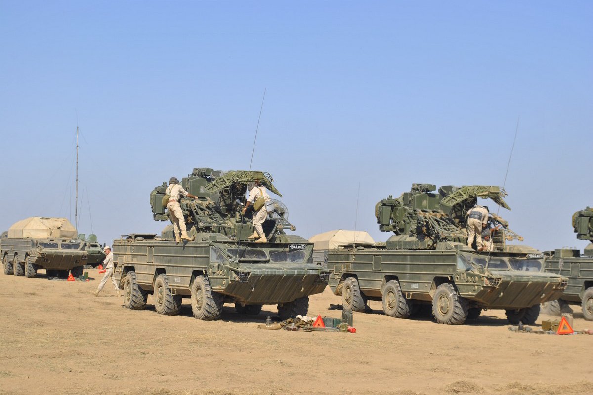
“Osa” anti-aircraft missile complexes at trainings; 2021. Photo: mil.ru
Russians declared several times their plans to re-arm the regiment with the following anti-aircraft systems: Buk M2, Buk M3, Tor-M2 during occupation of Sevastopol. However, as the Ministry of Defense of the Russian Federation informed, “Osa” and “Pantsyr” complexes from the regiment participated in the military training in 2021.
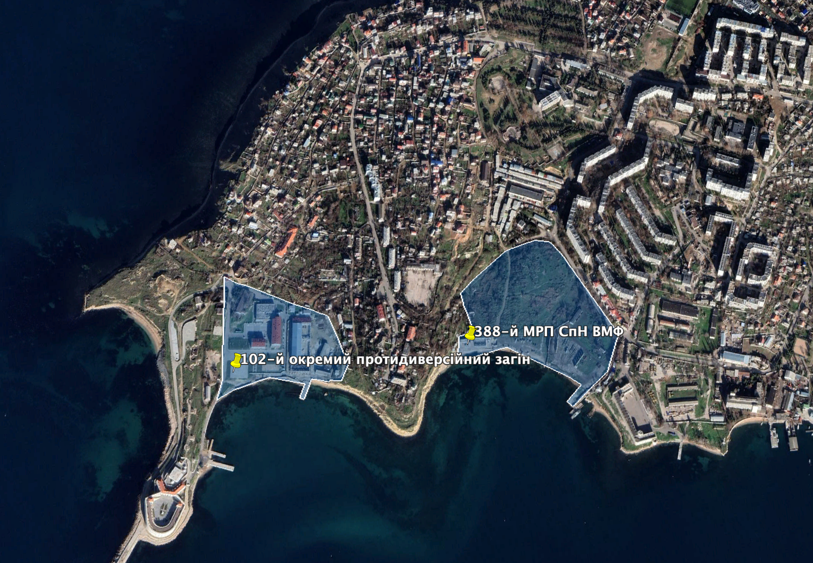
The 388th sea reconnaissance point of the Russian Navy and the 102th separate squad to fight underwater diversions. Photo: Google Earth
Another part of the 388th sea reconnaissance point of the Russian Navy is located in Matushenko Bay (coordinates 44.629712, 33.521834). The 102nd separate squad to fight underwater diversions is located in Kostyantynivska Bay (coordinates 44.629731, 33.516112).
Inhabitants of Kacha and Lubymivka as well as tourists should be aware that airfields are legitimate military targets for Ukrainian strikes.
Detonation at military warehouses could reach the area of several kilometers. The fire in Naftogavan may cause local environmental catastrophe covering Sevastopol, Inkerman and the Northern Side of the city. Military units (special purpose troops and anti-aircraft regiments) are located in the residential area. Bombing of these units could hit civilians living in the neighborhood.
Thus, Sevastopol residents should take care about their security as the Armed Forces of Ukraine are closer than people think.
OSINT-investigator Irakli Komakhidze published “Full list of fire hazard objects of Crimea”, with all Russian military objects in Crimea. They are all legitimate targets for the Armed Forces of Ukraine. We will try to describe them and show their locations.
This material is written by the information agency “The Center for Journalist Investigations” in partnership with the Center for Human Rights ZMINA.